
Plan your Idaho backpacking adventure.
There are a lot of ways to get to an Idaho wilderness backpacking trip. In our admittedly biased opinion, flying is one of the best. Not only can it give you amazing birds-eye views of the country you’ll be moving through, it offers faster and deeper access to the wilderness than any car can provide.
Why fly?
- See fewer people.
Flying is not a frequently used method of access for backpackers, so you get into country that a most people will never get to see! - Cover more ground
If you fly into an airstrip and backpack out to a car you staged at a backcountry trailhead, you’ll see twice the country you’d have seen doing an out and back from your car. - Choose from so many options
Between the Frank Church Wilderness and Selway Bitterroot Wilderness, you have a myriad of airstrips from which to choose. And most airstrips have a few different route options you can look into!
Interested in other Frank Church backcountry adventures? Check out our backcountry page.
Getting a Plan together
Take a look at the below, do some research, and then give us a call!
Be prepared.
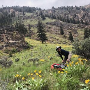
Wilderness travel in Idaho is no small undertaking.
Be sure you are physically up to the trip you are planning.
Also, consider doing some real homework to make sure you have the area knowledge, navigational skills, and appropriate gear and resources to ensure a safe trip.
Consider renting a satellite phone or in-reach in case of emergencies. Computer Zen can hook you up.
Explore options
Backpackers may find the IDFG Hunt Planner Map pretty useful. If you access this map from a desktop, you’ll see a menu on the left where you can turn layers on and off – like airstrips and non-motorized trails.
Note: you do need to zoom in a bit in order to see some of those layers as options.
When looking at trails on any map, keep in mind that the condition and maintenance level of trails varies widely, from very good to very bad.
Weather Considerations
Weather is always the boss. If weather is bad, we generally just wait for the next good window. We don’t usually have to delay for too long, but it can happen.
It’s good to have a satellite phone or an inReach so we can communicate if weather becomes an issue after we drop you off.
Routes to Look at:
Note: Conditions of all trails can and do change frequently. Feel free to look at the below ideas, but we don’t guarantee they’ll make for a good trip!
Do your own research to determine what trip works for your interest, skills, and abilities.
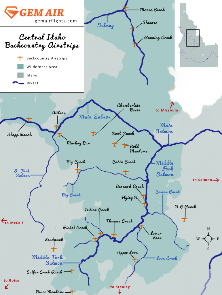
Fly into Shearer or Moose Creek on the Selway, and hike out to the car you staged near Race Creek campground.
Fly into Indian Creek on the Middle Fork Salmon and hike out to the car you staged at Boundary Creek transfer station.
Fly into Cold Meadows high country airstrip, and picked up at Chamberlain Basin airstrip.
Fly into Cabin Creek and hike and fish your way up to the car you staged near Big Creek Lodge.
Gem Air Aircraft
What our aircraft can carry depends on the strip and route to be flown, and can also depend on weather. To give you ballpark idea of what our planes can do, we’ve included some rules of thumb below – just keep in mind that the maximum loads for your flight may be different, depending on conditions and route. Want more info on our aircraft? Check out our aircraft page.
Cessna 172
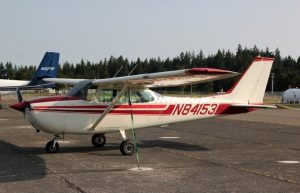
Can carry up to 500lbs. Good for flying 1 or 2 passengers into the backcountry. We don’t use this plane to pull people out of the backcountry.
Cessna 206
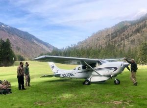
The backcountry staple. Can fly up to 1000lbs into the backcountry. Great for moving 3-4 hunters, depending on weights and gear.
Britten Norman Islander
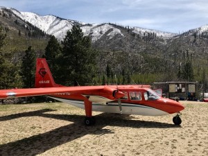
The backcountry pack mule. Can carry up to 1,700lbs into the backcountry. Larger groups, or those who are staying for a while and really bringing in a camp.
Idaho Backpacking Flights - Wilderness Map
This map helps show some of the options available to people who want to fly in to the Frank Church Wilderness and Selway Bitterroot Wilderness. It’s a fun map and gives some good reference, but it obviously should not be used for navigation!
Looking for a more accurate map? Check out the Idaho Fish and Game Hunt Planning map. It shows the different boundaries of each zone. You can also turn layers on and off, including a layer that shows USFS airstrips.
When to Book
We really really like it if you give us a month’s worth of notice, but we don’t actually have a deadline. If you call us up the day before and ask us for a flight, we will try really hard to get it figured out for you. That said, fair warning: in the busiest time of our season (mid-July through mid-August) our availability can sometimes be extremely limited for last minute calls.